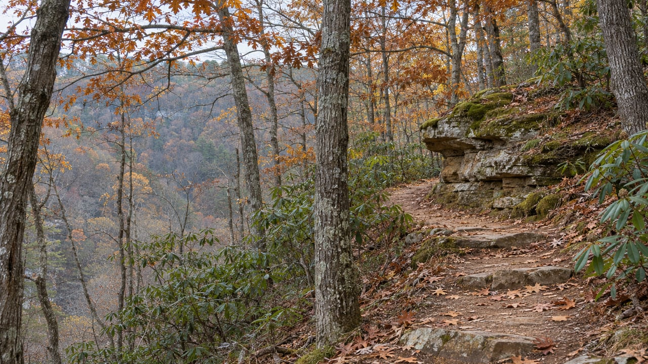
Last Friday afternoon, about 150 officials and guests gathered on a small hilltop in Sale Creek to dedicate Angel's Hollow State Park. Chattanoogan.com reported that the hilltop looks out over fields and ridges. The ceremony was held off a half-mile, L-shaped gravel road near the railroad crossing on Coulterville Road. County Mayor Weston Wamp and Tennessee Environment and Conservation Commissioner David Salyers pulled the cover off a wooden Angel's Hollow sign while two mounted rangers stood beside them. That sign will eventually stand at an entrance closer to Coulterville Road.
From 3 Gorges, the most useful detail is on the state's own park page. It says nearly all of the 2,500 acres is still closed. The one open piece is a section of the Cumberland Trail, the same footpath that starts at the Mowbray Pike trailhead and climbs through the gorges below Mowbray Mountain. Tennessee's 70th state park is new, and it sits on a trail many Soddy-Daisy hikers already use.
What the dedication delivered, and what it scheduled
Tennessee State Parks marks the property "Park Not Fully Open." It lists one 2.5-mile, out-and-back stretch of the Cumberland Trail to McGill Creek and says visitors should stay on designated open trails, because the rest of the park isn't open to the public yet. As of the Nov. 6, 2026 dedication, here's what is open and what is still planned:
| Piece of the park | Status after the Nov. 6, 2026 dedication |
|---|---|
| Cumberland Trail section to McGill Creek | Open for hiking, out-and-back |
| The rest of the roughly 2,500 acres | Not yet open to the public |
| Visitor center in Sale Creek | Planned |
| Paved entry road off Coulterville Road | Planned |
| RV, backcountry and primitive campsites | Planned |
| Family recreation facilities and new trails | Planned |
| McDonald Farm homestead and fairgrounds, about 300 acres | Kept as Hamilton County parkland |
The money is set aside. The General Assembly approved $45.3 million in the fiscal 2027 state budget for the park, according to the state's naming announcement. The Chattanooga Times Free Press reported that the funding covers both developing and maintaining the property, and that officials estimate about three years before the work is finished. For the next few seasons, the park's front door is a trail.
Of the 2,500 acres, 1,305 came from McDonald Farm and were transferred to the state by Hamilton County. The county kept more than 300 acres east of the railroad tracks, including the historic homestead and the fairgrounds where the Little Debbie Hamilton County Fair opened the same weekend as the dedication.
Follow the white blazes north from Mowbray Pike
The Cumberland Trail Conservancy, the group that maps the trail section by section, describes the route north from Soddy-Daisy as a chain of sections:
- Soddy Creek, starting at the Mowbray Pike trailhead. This is the first leg of the Three Gorges Segment.
- Possum Creek, the middle gorge of the three.
- Rock Creek, a 5.4-mile section rated strenuous. It runs from the Retro Hughes Trailhead to its northern end at the Upper and Lower Leggett Road trailheads.
- A gap. The McGill Creek section's southern end is planned for Leggett Road and Downey View Drive but isn't built yet.
- McGill Creek, running through Rhea and Hamilton counties. This is the stretch Tennessee State Parks now lists as the open part of Angel's Hollow.
Seen as a list, the new park is the next link in the trail Mowbray Mountain already lives on. The unfinished piece sits at Leggett Road, where the Three Gorges Segment ends and where the McGill Creek section is supposed to pick up.
The park's first manager knows this trail well. Officials named Daniel Basham, who Chattanoogan.com reported had been working with the Justin P. Wilson Cumberland Trail. The same report said officials hope to connect the trail fully with Angel's Hollow as more properties are secured. The Times Free Press described Basham as a 21-year Tennessee State Parks veteran and reported that a full connection would require buying more property first.
At the dedication, Basham told WDEF that the Cumberland Trail runs along the ridge behind the planned visitor center site and is "a very long state scenic trail that will reach from Signal Mountain all the way up to the Tennessee-Virginia border." From Mowbray Pike, the next piece of that long trail now runs through a state park.
Walking the open stretch to McGill Creek
The Cumberland Trail Conservancy's published access for the McGill Creek section is the Roaring Creek Trailhead on Brayton Mountain Road. 16705 Coulterville Road, the address the state lists for Angel's Hollow, is the park's address, and the land around it is still closed. According to the Conservancy, you reach the trailhead from Soddy-Daisy by taking US 27 north and turning left onto TN 303 for 0.4 mile. Then turn right onto Dayton Avenue, which is still TN 303, and take the first left onto Pikeville Avenue for 1.6 miles as it becomes Pikeville Boulevard and then Brayton Mountain Road. At a sharp left curve, look right for a gravel lot and a trailhead kiosk. The same lot is the southern trailhead for the Graysville Mountain section, which heads the other way.
Tennessee State Parks describes the open stretch as a 2.5-mile out-and-back leading to McGill Creek. The Conservancy rates the McGill Creek section moderate and lists it as in-and-out only. Its mile log for the section, measured from the Roaring Creek Trailhead, reaches the creek like this:
- Mile 0.3: a short, steep climb into a rocky bowl the Conservancy calls an "amphitheater." Wet-weather drainages run down into it, and stone steps carry you across.
- Mile 1.1: the trail meets Brayton Mountain Road on stone steps. A curbside spot here fits two or three cars and works as a middle trailhead for a shorter walk.
- Mile 1.2: past a yellow gate, a boulder looks down on the southern end of Cranmore Cove.
- Mile 2.2: after a gradual descent through hardwoods, the trail reaches McGill Creek.
Stay on the trail the state lists as open, since the rest of Angel's Hollow is still closed to the public.
The timing works this month. The Conservancy captions its photo of the descent to McGill Creek "Autumn colors in mid-November," and it lists fall color among the section's features. It also flags wet-weather crossings, so the drainages that make the amphitheater pretty after a hard rain also make footing harder. There are no designated campsites on this section. Check the Angel's Hollow page for the current access notice before you go, and see the state's Cumberland Trail hiking list, which currently shows the McGill Creek section as open.
Why the land ended up as a trail park instead of an industrial site
The trail connection is the reason this land became a park. The Times Free Press reported that Hamilton County bought McDonald Farm for $16 million, hoping to attract large industrial employers. Environmental and engineering studies then found that building the infrastructure that kind of industry needs would be prohibitively expensive. Last year Mayor Wamp proposed preserving the farm in exchange for opening 535 acres of Enterprise South Nature Park to possible industrial development. The plan drew wide public opposition, and he dropped it in January. A month later, Gov. Bill Lee announced plans to fund a state park.
At the ceremony, Chattanoogan.com reported, Commissioner Salyers credited Wamp and Sen. Bo Watson, chairman of the Senate finance committee, with explaining "the protection it had as a catalyst for being a conservation and outdoor recreation asset." Hamilton County Parks Director Matt Folz said he visited the land with other county officials three years ago, and they decided then that it needed to be protected.
The state is also counting on the park's economic value. TDEC Deputy Commissioner Brian Clifford, a Soddy-Daisy High graduate who emceed the dedication, cited estimates of an $11 million annual economic impact and 70 local jobs, according to the Times Free Press. State Rep. Greg Martin, whose district includes the park, said Hamilton County now has more state parks than any other county in Tennessee, and that state parks in the county already draw a million visitors a year.
Angel's Hollow is the 14th and final state park created under Gov. Lee, a record for a Tennessee governor, and the eighth dedicated this year. Its name also puts it first on the state's alphabetical list of parks and natural areas. The visitor center and campgrounds are a few years away. The trail is open now, and from Mowbray Mountain it's the next section north of a trail you can already walk to.
At Grace Frank Group, we follow changes like this one on Mowbray Mountain because they affect daily life here, from where your weekend hike ends to what moves in up the road. If you own on the mountain and want to know how your home stands today, request a home valuation and we'll put a local, data-informed number on it.